
The study says UHI archipelago, representing the combined effect of multiple localised heat islands, forming a broader area of elevated temperatures, was observed especially in the eastern and northern parts of the city.
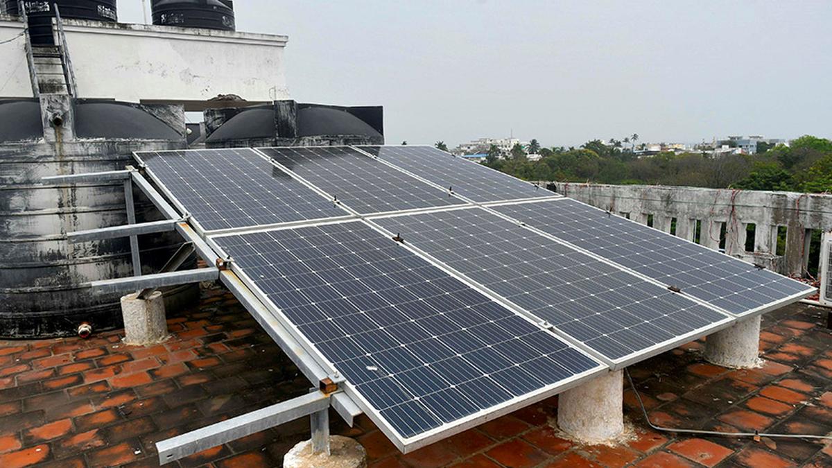
| Photo Credit: SPECIAL ARRANGEMENT
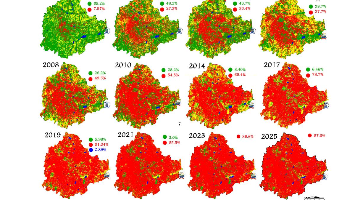
As Bengaluru’s once temperate climate turning increasingly warmer continues to be in the news, a newly published study reveals that 15.41 sq. km area in the city has very high temperature, even as land uses assessed using temporal remote sensing data from 1973 to 2025 showed a 1,078% increase in urban (built-up) area during the last five decades — from 7.97% in 1973 to 87.64% in 2025.
Only 168.93 sq. km area was under favourable conditions as per the Urban Thermal Field Variance Index (UTFVI), which evaluates the well-being of the environment concerning ecological thermal comfort while considering the Urban Heat Island (UHI) effect, whereas 545.25 sq. km was under unfavourable ecological conditions.
UHI archipelago, representing the combined effect of multiple localised heat islands, forming a broader area of elevated temperatures, was observed especially in the eastern and northern parts of the city, the study added.
Ambient air details
“Temporal ambient air temperature details complied from the India Meteorological Department monitoring stations in Bengaluru reveal that ambient temperature has shown an increasing trend with the alteration in landscape structure with an increase in paved surfaces (buildings, roads, etc.) and decline of natural porous surfaces (vegetation, lakes, etc.),” the study said. May temperatures went from 16 °C to 18 °C in the 70s, 19 °C in the 90s, 21 °C in 2000, 28 °C in 2010, and 34 °C in 2025, it added.
These findings coincide with the comparison of daily maximum temperatures from 2015 to 2024 against the World Meteorological Organization’s standard 1991-2020 climatological baseline, which showed that over the last 10 years, traditionally cooler cities such as Bengaluru and Mumbai have been experiencing more days with above-average temperatures than Delhi.
The study, ‘Urban heat island linkages with the landscape morphology,’ was conducted by T.V. Ramachandra, Rajesh Singh Rana, S. Vinay and Bharath H. Aithal, and published in the journal Nature on July 8. The micro level analyses was initiated to recommend appropriate building regulation to enhance the thermal comfort by the Directorate of Town and Country Planning following the high summer temperatures that the city witnessed in 2024. The study says that the Chief Town Planning Officer responded positively of incorporating the outcome of the research in the proposed Revised Master Plan 2031.
Bengaluru’s growth story
According to the researchers, Bengaluru witnessed spatial expansion in the mid-2000s with the formation of the Bruhat Bengaluru Mahanagara Palike by including adjacent rural landscapes, which led to the conversion of agricultural land to paved areas.
“The city landscape witnessed a 1,078% increase in built-up with a decline of 88% vegetation cover and 79% water bodies, leading to the transition of the landscape from porous to paved surfaces, affecting the hydrology, ecology, and socio-economic aspects. The urban trajectory in Bengaluru city exhibits distinct phases; from 1973 to 1992, steady annual growth of 1% driven primarily by the establishment of nationalised public sector industries, globalisation and subsequent relaxation in markets during the 90s witnessed by the emergence of the information technology (IT) sector,” the study said.
It added that the post-2002 era witnessed annual growth rates surging to 2.01% due to the proliferation of private industries and Special Economic Zones (SEZs). These developments generated employment opportunities and pushed a rapid conversion of peri-urban landscapes for residential and commercial development. The 2012–2021 period was characterised by intense urban growth driven by the increasing IT sector and the associated influx of population and annual urbanisation reached 3%, it said, adding that post-2021 witnessed annual urbanisation of 0.5% with the proliferation of residential layouts and a shift towards lower-density urban sprawl beyond the BBMP, engulfing the adjacent agrarian spaces.
Policy recommendations
Prof. Ramachandra from the Indian Institute of Science, who is one of the authors of the study, said policy recommendations to mitigate UHIs in cities should include increasing and protecting green spaces, integrating green infrastructure into urban development plans, a mini forest of native species in each ward to moderate local temperature, maintaining 30% open spaces with green cover at plot levels, connecting fragmented tree patches for promotion of ecosystem health and sustainability, rejuvenating the 216 lakes to retain rainwater and facilitate groundwater recharge, among others.
Published – July 09, 2025 10:02 pm IST